Filter by
Learning materials (3)
RSSShowing results 1 to 3
Type of material
- Highlighted
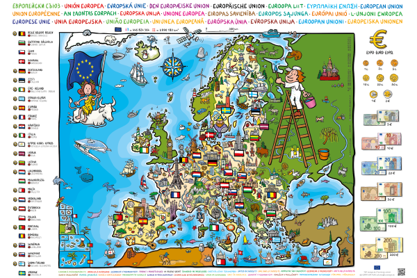
United in Diversity
Poster for children showing a map of Europe with little pictures that illustrate some of the national characteristics and traditions of each country.
- Age groups
- Up to 9 yearsAges 9 to 12
European Atlas of the Seas
Explore, collate and create your own sea map.Learn more about Europe's seas and coasts, their environment, related human activities and European polic...
- Age groups
- Ages 12 to 15Ages 15 and over

Travelling in Europe
Europe is home to some of the world’s most popular travel destinations and it's easier to explore than ever, thanks to the EU.
- Age groups
- Ages 15 and over